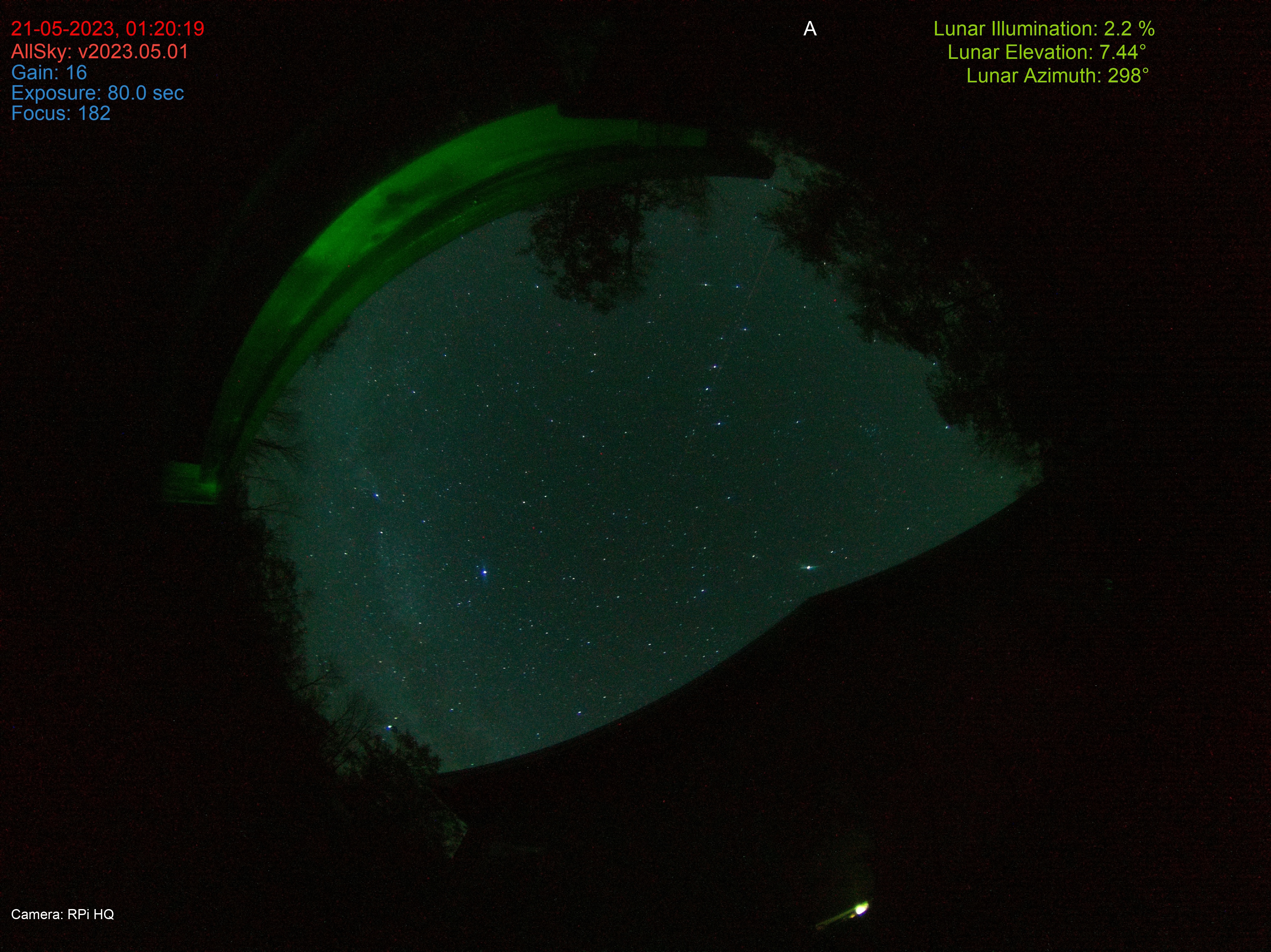
The image below was produced during a test run of an all-sky camera based around a Raspberry Pi computer and a Pi HQ camera wrapped in control software from Thomas Pacquin and available via GitHub. The images were taken from my cottage on the Saugeen Peninsula, Ontario, which is nominally a Bortle 2 site.* I’m right on the border from Bortle 2 and Bortle 1, and I like to think of it as a Bortle 1.5 site – i.e., very dark.
*Bortle numbers are a measure of the sky visual quality based around the level of light pollution on a scale 1 to 9, with 9 as the worst level. <https://en.wikipedia.org/wiki/Bortle_scale>
The Milky Way is visible with dark lane on the left side of the image and the Summer Triangle is just rising. North should be at the top, but I was slightly off in placing the camera – rotate the view slight clockwise. You can find the pole by following the pointer stars of the Dipper to Polaris, just to the left of the tree at the top of the frame.
Normally when we look at a map with North at the top, West is to the left of the map, but in this image that’s not the case. Remember, the camera pointing straight up! East is on the left side of the image, so your viewpoint is a little skewed – disorienting, if you will.
To get the correct perspective here, try holding your copy of the image above your head with north up and aligned with the pole. East and West will then be in the “normal” positions.
RPTattersall©2023
